This 7.3 km walking loop around the Torrent du Chagne is listed as taking three hours, with 303 m of ascent and a moderate difficulty rating. The start marker is the one provided by the tourist office in Guillestre. In winter, the section between the Chanterane and Peyre Bartino bridges is reserved for cross-country skiing; check snow, ice and restrictions before setting off.
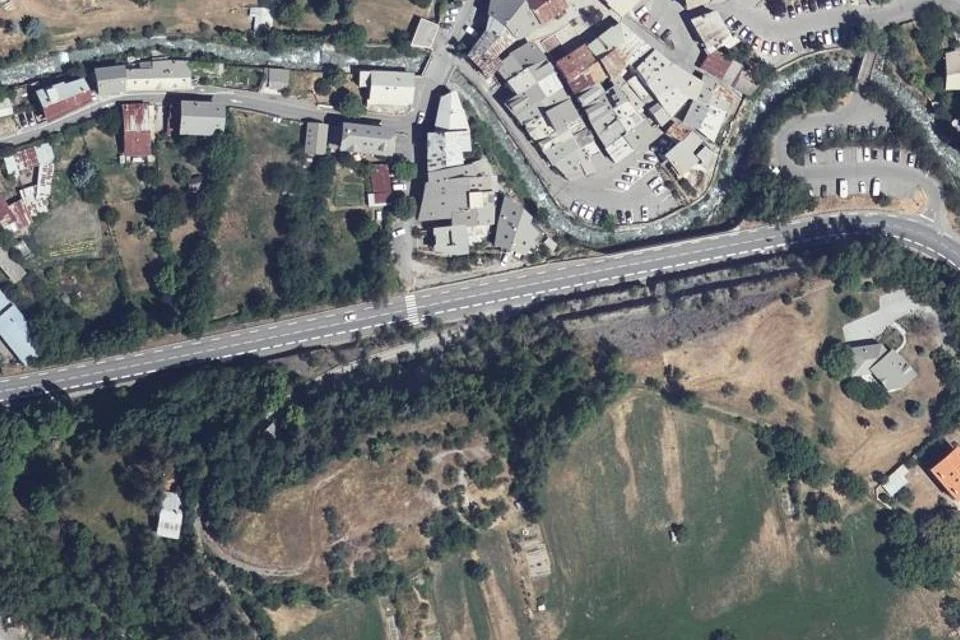
Published starting point for Torrent du Chagne in Guillestre. IGN aerial photograph, taken in 2025. View of the starting point and surroundings; it does not replace the route map. IGN · Licence Ouverte 2.0 · Credits · Extract from the BD ORTHO photographic basemap, WebP compression and thumbnail; no generation or added visual elements.
Plan your visit
Address
Point de départ publié par l’office de tourisme à Guillestre ; suivre le tracé et le balisage du Torrent du Chagne, 05600 Guillestre
Access and precautions
Start marker provided on the official listing; consult its GPX track for the route. In winter, the Pont de Chanterane–Pont de Peyre Bartino section is reserved for cross-country skiing. Check snow, ice, weather and local restrictions before setting off.
Duration
3 hours
Distance
7.3 km
Difficulty
Moderate
Prices
Check prices with the venue on its official website.